We are an independent consultancy of urban designers working to create robust and imaginative contributions to the built environment.
We develop responsive masterplans and visions for urban areas with a strong public conscience.
We aim to create distinctive places of exceptional quality through a socially engaged design process.
︎ Home
︎ Recent News
︎ Who We Are
︎ Our Projects
︎ Our Services
♡ Journal
︎ Contact
We are an independent consultancy of urban designers working to create robust and imaginative contributions to the built environment.
We develop responsive masterplans and visions for urban areas with a strong public conscience.
We aim to create distinctive places of exceptional quality through a socially engaged design process.
︎ Home
︎ Recent News
︎ Who We Are
︎ Our Projects
︎ Contact
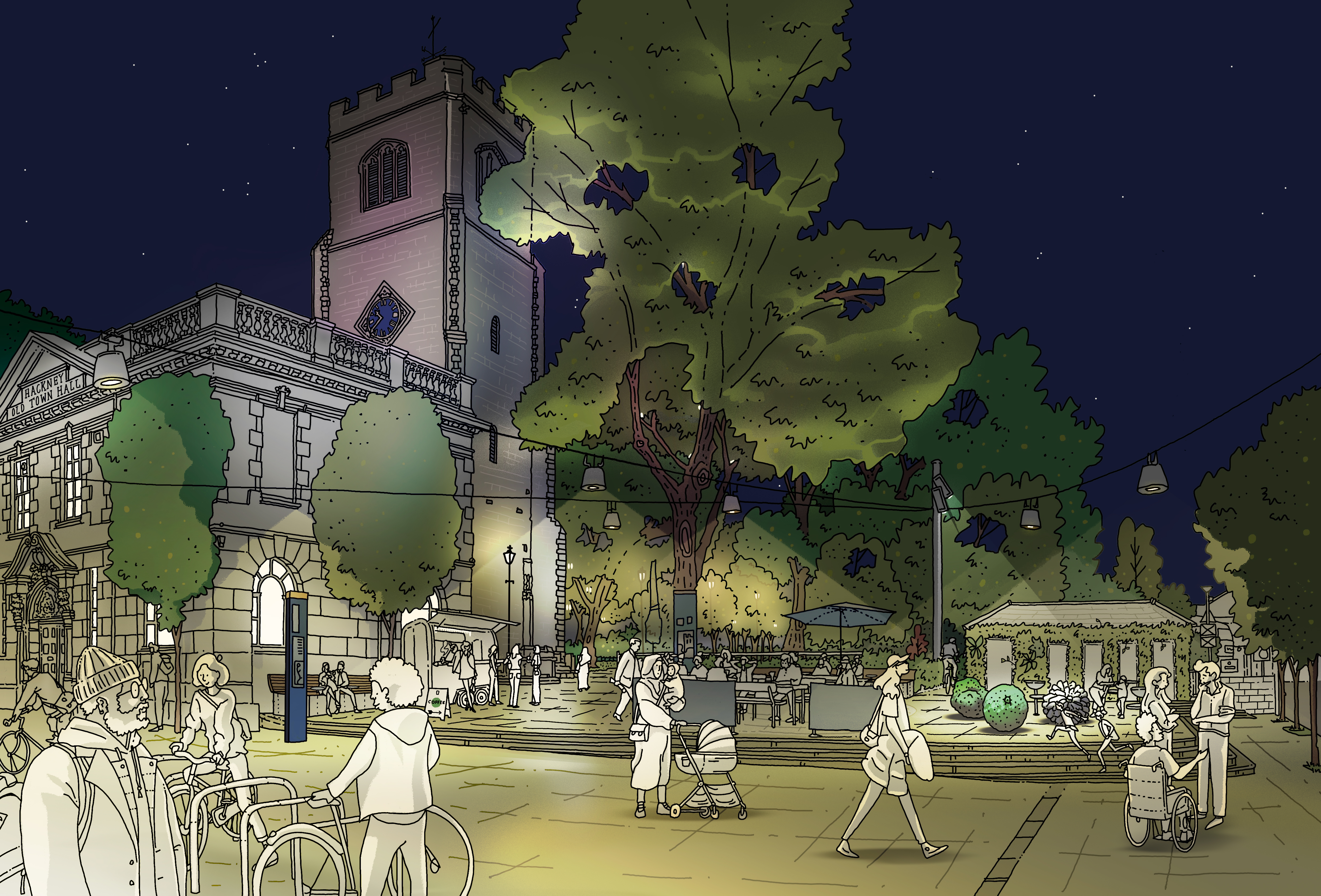
Hackney Central Wayfinding Strategy
Area of transformation
Hackney Central, a vibrant and active neighbourhood in the heart of the borough, is a prominent commercial, cultural and civic hub with characterful streets and green spaces. The local people still remember it just a couple of decades ago - struggling with poverty, crime, and neglect - before Hackney turned the ship around through harnessing the market forces and massive investment in regeneration. As a practice, we were immersed in this transformation and experienced its benefits firsthand, as our Hackney office is in an area that became an increasingly trendy and desirable destination to live, work and visit.
However, as was expressed in our conversations with the local residents, this fundamental change and the population churn can lead to major changes in how people interact with the city. As the footfall grows, the street space needs to work harder to comfortably accommodate all users and activities. More and more people rely on navigation aid to find their way around. At the same time, long-standing residents might feel overlooked if their cultural identities and aspirations are underrepresented in the regeneration efforts.
The Council aims to recognise and protect the local pride and civic heart of Hackney through a series of targeted strategies. The recently adopted Hackney Central Town Centre Strategy serves as a guide for town centre regeneration, and serves as a direct expression of the priorities of local communities captured through engagement. Building on this, the Council appointed AR Urbanism and Air Design to explore opportunities to enhance the area's sense of place, improve navigation, and create a more accessible and inviting active travel network.
A strategy for natural wayfinding
Wayfinding is more than connecting A to B, it encompasses all urban behaviour, from orientation to identification, exploration and discovery. We use wayfinding information and our surrounding environment to read, understand and experience a place, and to help inform our decisions of how we travel, where we visit and how we interact with a place.
There are a number of widely recognised and traditional tools used to deliver wayfinding information including the signage and mapping products such as Legible London, although these are only part of an considered and effective system. The urban environment and its geographic features, architecture, landmarks, public spaces, landscaping, materials, art and lighting also play an important role in the influencing of journeys and communicating a sense of place.
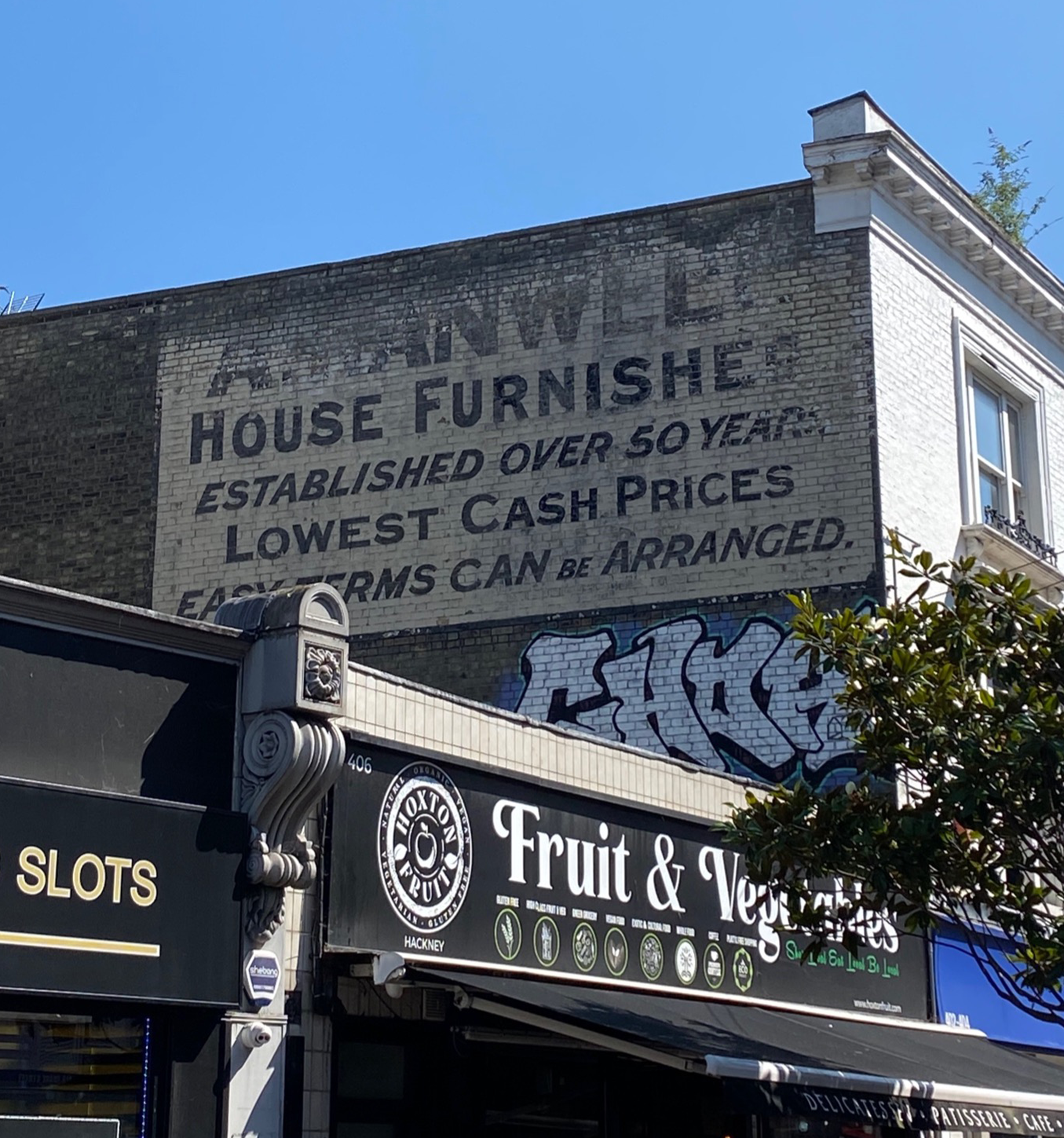 A faded historic sign to be enhanced for improved way-finding.
In our Wayfinding Strategy we have employed a highly place-sensitive approach that builds on the existing urban fabric, reflecting on Gordon Cullen’s “serial vision” concept. Serial vision refers to the shifting perspectives and sequential views experienced while moving through space, shaping our perception as landscapes unfold. Cullen saw it as more than a visual phenomenon, emphasising its emotional and psychological impact on how we navigate and interpret our surroundings.
Our Wayfinding Strategy includes creating or enhancing local landmarks where navigation aid is needed, while improving public realm, lighting and landscaping on the key routes. This bold approach works with kinesthetic experience of the street, reduces the need for traditional signage and gives plenty of opportunities for collaboration with local community groups, artists and makers.
Synergies in engagement, design and delivery
The project commenced amid ongoing community and stakeholder engagement for other interventions in the area. The Council’s communication strategy ensures co-production of the engagement events to prevent engagement overload and align the overall discussion across various regeneration initiatives.
The engagement for the Wayfinding Strategy was therefore fully integrated into the planned stream. We worked alongside other teams, shared plans and findings, which allowed us to expand the Strategy's toolset to include the interventions being delivered as part of the other projects. One example is the close synergy with the Town Hall Square improvement project: our proposals are plugging into the planned layout, amplifying the potential of the place.
The challenge of Mare Street
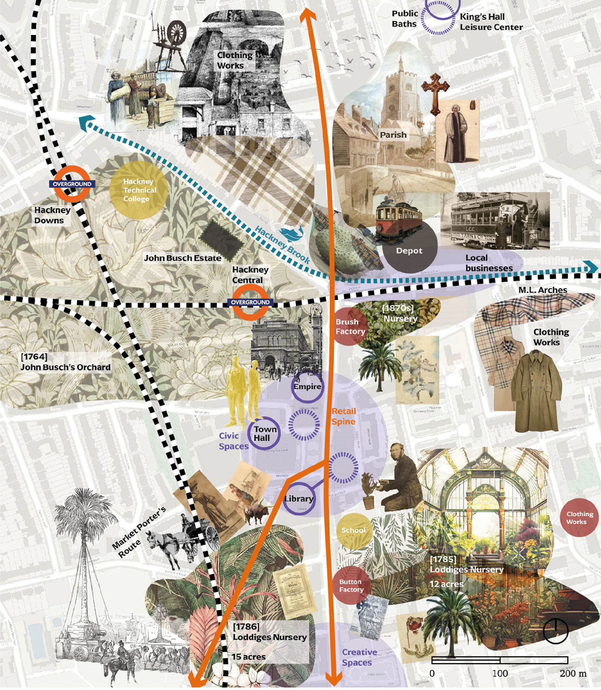
Most of the proposals in the Strategy are addressing the key issue identified in the analysis and engagement - Mare Street with its traffic and street grid nuances is a significant barrier for pedestrian movement and accessibility in the area. The complexity of this challenge requires a coordinated approach to optimising street geometry, enhancing safety and legibility through accessible pedestrian crossings and clear well-lit routes, and creating a public realm that is both functional and reflective of local identity.
We have identified key active travel routes passing through Hackney Central. East-west routes address crossing Mare Street and onward journeys, while north-south routes are being improved to provide alternatives to Mate Street, and distribute the footfall more evenly, taking the pressure off the busy pavements on the main route.
Mare Street Crossings is one important, forward-looking project. We envision this route as a fully walkable town centre street with active commercial frontages on both sides, ensuring seamless movement across. The optimal crossing widths are proposed, and locations for new crossings are identified, along with the potential public realm improvements.
An example of a north-south link is the route from Hackney Grove to Hackney Central Station, weaving through a complex yet characterful urban fabric lined with cultural and civic institutions. We identified and designed locations for targeted public realm improvements and interpretive elements along the route. Each intervention is strategically placed for visibility, serving as both a navigation aid and an amenity for nearby institutions.
Other key projects deal with place-specific challenges on the routes adjacent to Mare Street. They unlock the full potential of the streetscape in those locations, and create visually striking and memorable places that attract visitors and tell the stories of Hackney Central in a creative way. For example, enhancements to the path at Hackney Central Overground’s north entrance could improve visibility with a bespoke installation and integrated surface treatments, making the Overground route more identifiable.
Designing for incremental change
A core component of the Strategy is the Project Bank - the main tool in ensuring the vision, specific projects, and their details are communicated to the relevant stakeholders. It includes a set of projects with a detailed description of the design approach, elements, phases (including testing through tactical urbanism interventions), quick wins, benefits, sensitivities, and potential synergies with other local initiatives. The 19 identified projects are categorised by the ease of delivery and required budget.
Each project description within the Project Bank provides a clear design framework that can be deployed when funding allows. This approach ensures a gradual and coordinated approach to achieving the strategy outcome, even if the projects are delivered separately.